Showing posts with label Lunar Reconnaissance Orbiter. Show all posts

Monday, March 24, 2025

The Third Blue Ghost Lander Will Carry a Wheeled Passenger to the Moon...

An artist's concept of Firefly Aerospace's Blue Ghost lunar lander and Honeybee Robotics' rover on the surface of the Moon.
Firefly Aerospace

Firefly Aerospace Selects Blue Origin’s Honeybee Robotics to Provide Rover for Lunar Mission to Gruithuisen Domes (Press Release)

Cedar Park, Texas – Firefly Aerospace and Honeybee Robotics, a Blue Origin company, today announced that Honeybee was contracted by Firefly to provide the lunar rover for the company’s recently-awarded NASA task order to explore the Gruithuisen Domes on the Moon’s near side in 2028. Once deployed on the Moon by Firefly’s Blue Ghost lander, Honeybee’s rover will carry NASA instruments to investigate the unique composition of the Gruithuisen Domes – a part of the Moon that has never been explored.

“We’re excited to support Firefly’s mission to the Gruithuisen Domes by providing surface mobility, a key capability for lunar permanence,” said Paul Ebertz, senior vice president of In-Space Systems, Blue Origin. “With this rover, Honeybee Robotics builds on its legacy of advanced robotics and hardware designed for exploration throughout our Solar System.”

During mission operations, Firefly’s Elytra Dark transfer vehicle will first deploy the Blue Ghost lander into lunar orbit and then remain on orbit to provide long-haul communications. Blue Ghost will then land in the Gruithuisen Domes, deploy the Honeybee Robotics rover, and support payload operations for approximately 14 days on the lunar surface.

“Firefly is proud to partner with Honeybee Robotics to help us explore the challenging Gruithuisen Domes terrain on our third mission to the Moon,” said Shea Ferring, Chief Technology Officer at Firefly Aerospace. “The Firefly team has worked closely with Honeybee on two payloads – the Lunar PlanetVac and LISTER subsurface drill – that were successfully operated on our first Blue Ghost mission to the Moon. Their stellar team, robust rover solution, and flight-proven technologies made Honeybee the obvious choice!”

As part of Firefly’s third mission to the Moon, Honeybee’s rover will help investigate the subsurface composition of the Gruithuisen Gamma Dome carrying elements of NASA’s Lunar Vulkan Imaging and Spectroscopy Explorer (Lunar-VISE) suite. Lunar-VISE has multiple instruments, including two cameras attached to Firefly’s Blue Ghost lander that will characterize the landing site and rover traverse as well as an infrared multi-spectral camera system and a spectrometer attached to Honeybee’s rover that will measure gamma ray and neutron emissions.

The rover will travel along the southern edge of the Gruithuisen Gamma Dome and through a boulder field to reach the rim of a recent impact crater. The rover will then traverse back to the lander just before sunset to enable repeat observations of boulder targets at different solar illumination angles.

In total, there are six NASA-sponsored payloads onboard Firefly’s Blue Ghost Mission 3 that aim to uncover the composition and fundamental volcanic processes that formed the domes, in addition to other science investigations and technology demonstrations. This mission will follow Firefly’s first mission to the Moon that successfully landed in Mare Crisium and completed 14 days of surface operations in March 2025. Firefly’s second lunar mission is set to launch in 2026 with operations in lunar orbit and on the far side of the Moon.

Source: Firefly Aerospace

****

An earlier art concept of a Blue Ghost lander, as well as a rover built by an industry provider, that Firefly Aerospace will send to the Moon on its third NASA CLPS mission in 2028.
Firefly Aerospace

An image of the Gruithuisen Domes...taken by NASA's Lunar Reconnaissance Orbiter.
NASA / GSFC / Arizona State University

Tuesday, March 11, 2025

Photos of the Day: Orbital Images of Athena on the Lunar Surface...

A photo that NASA's Lunar Reconnaissance Orbiter took of Intuitive Machines' Athena lander lying inside a small crater at the Mons Mouton region in the Moon's South Pole...on March 10, 2025 (at 14:52 UTC).
NASA / GSFC / Arizona State University

Just thought I'd share these images that NASA's Lunar Reconnaissance Orbiter recently took of Intuitive Machines' Athena lander on the Moon's surface.

Athena, with Lunar Outpost's MAPP rover aboard, touched down at the Mons Mouton region in the Moon's South Pole on March 6...but Athena's mission (IM-2) was abruptly cut short after the spacecraft tipped over upon landing inside a small crater, preventing sunlight from recharging the craft's batteries.

The IM-2 mission didn't even last 24 hours on the lunar surface.

An unannotated version of the photo that NASA's Lunar Reconnaissance Orbiter took of Intuitive Machines' Athena lander inside a small crater at the Mons Mouton region in the Moon's South Pole...on March 10, 2025 (at 14:52 UTC).
NASA / GSFC / Arizona State University

An earlier photo that NASA's Lunar Reconnaissance Orbiter took of Intuitive Machines' Athena lander lying inside a small crater at the Mons Mouton region in the Moon's South Pole...on March 7, 2025.
NASA / GSFC / Arizona State University

A cropped version of the photo that NASA's Lunar Reconnaissance Orbiter took of Intuitive Machines' Athena lander inside a small crater at the Mons Mouton region in the Moon's South Pole...on March 7, 2025.
NASA / GSFC / Arizona State University

Thursday, March 06, 2025

Photos of the Day: Orbital Images of Blue Ghost on the Moon!

An animated GIF showing before-and-after images of Blue Ghost's landing site on the Moon...on March 3, 2025.
NASA / GSFC / Arizona State University

Just thought I'd share these images that NASA's Lunar Reconnaissance Orbiter recently took of Firefly Aerospace's Blue Ghost lander on the Moon's surface!

Blue Ghost successfully touched down near the Mons Latreille region at Mare Crisium on March 2...and continues to hum along as it carries out 10 science experiments for NASA under its Artemis and Commercial Lunar Payload Services programs.

Assuming that everything continues to proceed as planned, Blue Ghost Mission 1 will last till Sunday, March 16.

Another photo that NASA's Lunar Reconnaissance Orbiter took of Firefly Aerospace's Blue Ghost lander at Mare Crisium on the Moon...on March 2, 2025.
NASA / GSFC / Arizona State University

A cropped version of the photo that NASA's Lunar Reconnaissance Orbiter took of Firefly Aerospace's Blue Ghost lander at Mare Crisium on the Moon...on March 2, 2025.
NASA / GSFC / Arizona State University


Friday, April 05, 2024

The Lunar Reconnaissance Orbiter Has Imaged Another Spacecraft Orbiting the Moon (and Vice Versa)...

The streak in the middle of this photo is South Korea's Danuri spacecraft...as seen by NASA's Lunar Reconnaissance Orbiter from 2.5 miles (4 kilometers) away last month.
NASA / Goddard / Arizona State University

NASA’s LRO Finds Photo Op as It Zips Past South Korea’s Danuri Moon Orbiter (News Release)

NASA’s LRO (Lunar Reconnaissance Orbiter), which has been circling and studying the Moon for 15 years, captured several images of Korea Aerospace Research Institute’s Danuri lunar orbiter last month. The two spacecraft, traveling in nearly parallel orbits, zipped past each other in opposite directions between March 5 and 6, 2024.

LRO’s narrow angle camera (one in a suite of cameras known as “LROC”) captured the images featured here during three orbits that happened to be close enough to Danuri’s to grab snapshots.

Due to the fast relative velocities between the two spacecraft (about 7,200 miles, or 1,500 kilometers, per hour), the LRO operations team at NASA’s Goddard Space Flight Center in Greenbelt, Maryland, needed exquisite timing in pointing LROC to the right place at the right time to catch a glimpse of Danuri, the Republic of Korea’s first spacecraft at the Moon. Danuri has been in lunar orbit since December 2022.

Although LRO’s camera exposure time was very short, only 0.338 milliseconds, Danuri still appears smeared to 10 times its size in the opposite direction of travel because of the relative high-travel velocities between the two spacecraft.

LRO is managed by NASA’s Goddard Space Flight Center in Greenbelt, Maryland, for the Science Mission Directorate at NASA Headquarters in Washington. Launched on June 18, 2009, LRO has collected a treasure trove of data with its seven powerful instruments, making an invaluable contribution to our knowledge about the Moon.

NASA is returning to the Moon with commercial and international partners to expand human presence in space and bring back new knowledge and opportunities.

Source: NASA.Gov

****

The streak in the middle of this photo is South Korea's Danuri spacecraft...as seen by NASA's Lunar Reconnaissance Orbiter from 3 miles (5 kilometers) away last month.
NASA / Goddard / Arizona State University

NASA's Lunar Reconnaissance Orbiter as seen by South Korea's Danuri spacecraft from 11 miles (18 kilometers) above...on April 7, 2023.
NASA / KARI / Arizona State University

Thursday, February 29, 2024

Goodnight, Odysseus... Thanks for Putting My Message on the Moon!

A photo of Intuitive Machines' Odysseus lander on the surface of the Moon.
Intuitive Machines

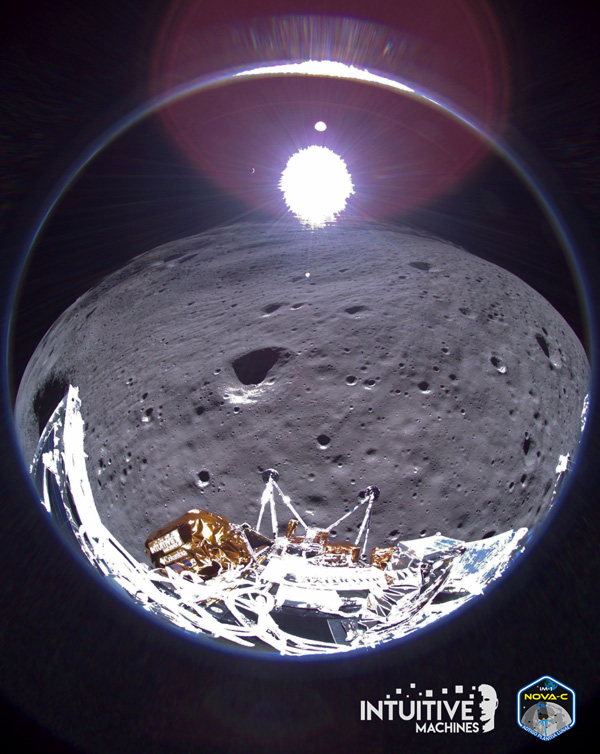
Happy Leap Day, everyone! Just thought I'd share these images that were released by Intuitive Machines this week as its Odysseus ('Odie') lunar lander was put to sleep due to low battery power today...nevertheless completing the successful seven-day IM-1 mission.

This mission was very significant to me. To NASA, this was the United States' first landing on the Moon since Apollo 17 in 1972. To the burgeoning commercial space industry, this was the first privately-built spacecraft to successfully touch down on the lunar surface.

And to myself, Odie's accomplishment marked the conclusion of me waiting around 15 years for a lander mission to come along that would put my virtual presence on the surface of the Moon! NASA's Lunar Reconnaissance Orbiter—which bears a microchip containing my name as well as those of 1.6 million other people—has been revolving around Earth's natural satellite since June of 2009.

But it wouldn't be till IM-1 this month that my dream of looking up at the Moon and thinking about how I had a presence intact on its surface, courtesy of a Lunagram message (shown at the very bottom of this Blog entry) that I submitted to a company named Lunaprise back on Christmas Day of 2020, became a reality.

Much thanks to Intuitive Machines, NASA (whose Commercial Lunar Payload Services initiative for the Artemis program made IM-1 a reality), SpaceX (which flawlessly launched Odie to the Moon on February 15), Lunaprise and the Arch Mission Foundation (which helped provide the NanoFiche disc that contains Lunagrams as well as the Arch Mission's Lunar Library) for giving me the opportunity to be a part of this historic endeavor!

There are other Moon-bound spacecraft, such as NASA's VIPER rover and Firefly's Blue Ghost lander, that will hopefully bring my presence to other locales on the lunar surface over the next two years. But it will be Odysseus, just like NASA's Phoenix lander (which was the first robotic probe to land my name on Mars back in 2008), that will be the lunar explorer I'm most fond of.

Ad Lunam.

A photo of the NanoFiche disc, which contains my Lunagram as part of the Arch Mission Foundation's Lunar Library, attached to the Odysseus lander.
Intuitive Machines

A photo of the Odysseus lander, with the NanoFiche disc attached to its side, before the spacecraft was encapsulated by the twin payload fairings of its SpaceX Falcon 9 rocket.
SpaceX

This final photo that was transmitted by Odysseus to Earth on February 29, 2024, shows the spacecraft as it descended towards the lunar surface for a landing...on February 22, 2024.

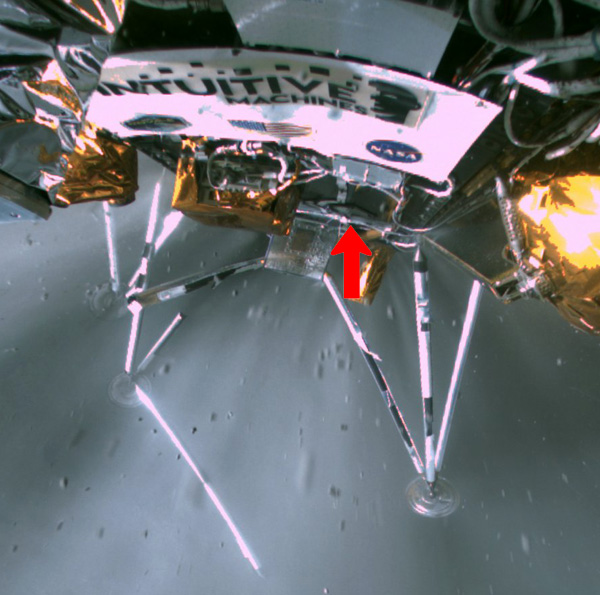
The NanoFiche disc is visible above one of Odysseus' landing legs as the spacecraft touched down on the Moon...on February 22, 2024. The rough landing damaged the leg to the left.
Intuitive Machines

My Lunagram message (with most of its details blurred out) that's now on the surface of the Moon...thanks to the Odysseus spacecraft and the Lunar Library aboard it.

Tuesday, September 05, 2023

India's Resounding Success Has Been Spotted on the Moon's Surface by a U.S. Spacecraft...

An image of India's Vikram Lander on the surface at the Moon's South Polar Region...as seen by NASA's Lunar Reconnaissance Orbiter on August 27, 2023.
NASA's Goddard Space Flight Center / Arizona State University

NASA’s LRO Observes Chandrayaan-3 Landing Site (News Release)

NASA’s LRO – the Lunar Reconnaissance Orbiter – spacecraft imaged the Chandrayaan-3 landing site on the Moon’s surface.

The ISRO (Indian Space Research Organization) Chandrayaan-3 touched down on the Moon on August 23, 2023. The Chandrayaan-3 landing site is located about 600 kilometers from the Moon’s South Pole.

The LROC (short for LRO Camera) acquired an oblique view (42-degree slew angle) of the lander four days later. The bright halo around the vehicle resulted from the rocket plume interacting with the fine-grained regolith (soil).

Visit the ISRO gallery of Chandrayaan-3 images.

Source: NASA.Gov

****

A 3D version of the image that India's Pragyan Rover took of the Vikram Lander on the lunar surface...on August 30, 2023.
ISRO / SAC / LEOS


Friday, September 01, 2023

Russia's Latest Failure May Have Been Spotted on the Moon's Surface by a U.S. Spacecraft...

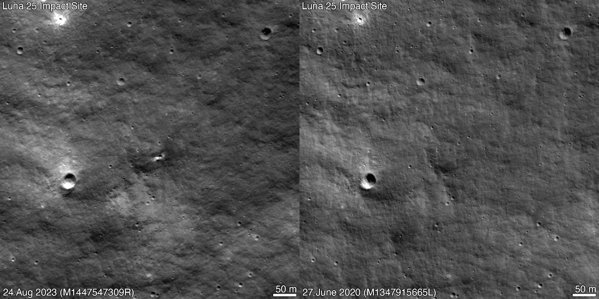
An animated GIF showing the possible impact site of Russia's Luna 25 spacecraft on the surface of the Moon...as seen by NASA's Lunar Reconnaissance Orbiter.
NASA’s Goddard Space Flight Center / Arizona State University

NASA’s LRO Observes Crater Likely from Luna 25 Impact (News Release - August 31)

NASA’s LRO – the Lunar Reconnaissance Orbiter – spacecraft imaged a new crater on the Moon’s surface that is likely the impact site of Russia’s Luna 25 mission.

During its descent, Luna 25 experienced an anomaly that caused it to impact the surface of the Moon on August 19.

Roscosmos, Russia’s space agency, published an estimate of the impact point on August 21. The LROC (short for LRO Camera) team and the LRO Mission Operations team were able to design and send commands to the LRO spacecraft on August 22 to capture images of the site.

The sequence began on August 24 at 2:15 p.m. EDT (18:15 UTC) and was completed about four hours later, at 6:12 p.m. EDT (22:12 UTC). The LROC team compared images taken prior to the impact time and the sequence taken after and found a small new crater.

LRO’s most recent "before" image of the area was captured in June 2022 (frame No. M1410024427R above); thus, the crater formed sometime after that date. Since this new crater is close to the Luna 25 estimated impact point, the LRO team concludes it is likely to be from that mission, rather than a natural impactor.

The new crater is about 10 meters in diameter and is located at 57.865° south latitude and 61.360° east longitude at an elevation of about -360 meters. The impact point was on the steep (greater than 20° grade) inner rim of Pontécoulant G crater, about 400 kilometers short of Luna 25’s intended landing point at 69.545° south, 43.544° east.

Source: NASA.Gov

****

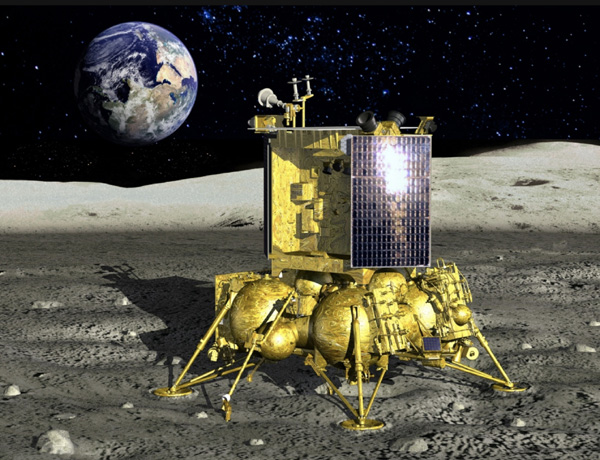
An artist's concept of Russia's Luna 25 spacecraft if it successfully landed on the Moon.
N.P.O. Lavochkin (www.laspace.ru)

Friday, May 26, 2023

Nova-C Will Touch Down at a New Region on the Moon...

Intuitive Machines' Nova-C lander successfully completed launch vibration tests in preparation for its flight to the Moon...scheduled to lift off from Cape Canaveral Space Force Station in Florida during the late summer of this year.
Intuitive Machines

Intuitive Machines Lunar Landing Site Moves to South Pole (News Release - May 25)

NASA, in cooperation with Intuitive Machines, is moving the landing site for the first Commercial Lunar Payload Services (CLPS) mission to the Moon’s South Pole as an important first step in managing risks for future Artemis landings.

One of the first lunar payload deliveries under NASA’s CLPS initiative was awarded to Intuitive Machines in May 2019. The company’s first flight, Intuitive Machines-1 (IM-1) will carry six NASA payloads on its Nova-C lunar lander to a site near the Malapert A crater.

This relatively flat and safe region is within the heavily-cratered southern highlands on the side of the Moon visible from Earth.

The NASA payloads will focus on demonstrating communication, navigation and precision landing technologies, and gathering scientific data about rocket plume and lunar surface interactions, as well as space weather and lunar surface interactions affecting radio astronomy. Through the CLPS initiative, NASA is supporting the development of a lunar economy by working with American companies to deliver scientific, exploration and technology payloads to the Moon’s surface and lunar orbit.

The decision to move from the original landing site in Oceanus Procellarum was based on a need to learn more about terrain and communications near the lunar South Pole, which is expected to be one of the best locations for a sustained human presence on the Moon. Landing near Malapert A will also help mission planners understand how to communicate and send data back to Earth from a location that is low on the lunar horizon.

The landing date is expected in the third quarter of 2023.

While NASA is the primary customer purchasing lunar delivery services, CLPS vendors also work with other customers to send non-NASA payloads to the Moon. CLPS providers are responsible for managing their activities to ensure they are compliant with NASA schedule requirements.

Intuitive Machines will confirm the launch date, lunar landing date and duration of lunar surface operations, as well as updates on the thermal environment that the payloads will experience, given the temperature extremes for lunar transit and at the lunar South Pole.

Source: NASA.Gov

****

The Malapert A region, which is where Intuitive Machine's Nova-C lander will hopefully touch down later this summer, is seen near the top of this topographical map of the Moon's South Pole...using data collected by NASA's Lunar Reconnaissance Orbiter.
Lunar and Planetary Institute Regional Planetary Image Facility

Thursday, February 02, 2023

Not Lacus Mortis: The Peregrine Spacecraft Will Be Touching Down at Another Location on the Moon...

Assembly is completed on the Peregrine lunar lander inside the cleanroom at Astrobotic's headquarters in Pittsburgh, PA...in November of 2022.
Astrobotic

New Landing Site Will Upgrade Science Returns for Astrobotic Flight (News Release)

Through the Commercial Lunar Payload Services (CLPS) initiative, NASA is working with American companies to deliver scientific, exploration and technology payloads to the Moon’s surface and orbit. The science investigations and technology demonstrations delivered to the lunar surface through CLPS are part of the agency’s broader goal of returning humans to the Moon through Artemis, and the success of CLPS could help further establish American leadership in the global and commercial space industries.

Astrobotic’s first orders for scientific payload delivery were awarded in May of 2019. Astrobotic will deliver NASA payloads on its first flight to the lunar surface using the company’s Peregrine lunar lander.

These NASA payloads will investigate specific aspects in and around the landing site. Astrobotic will also carry some non-NASA payloads from other organizations.

The original landing site for Astrobotic’s flight within Lacus Mortis, which is in the northeast quadrant of the lunar nearside of the Moon, was chosen by Astrobotic to suit its lander performance and safety, as well as Astrobotic’s preferences. However, as NASA’s Artemis activities mature, it became evident that the agency could increase the scientific value of the NASA payloads if they were delivered to a different location.

The science and technology payloads planned for this delivery to the Moon presented NASA scientists with a valuable opportunity, prompting the relocation of the landing site to a mare – an ancient hardened lava flow – outside of the Gruithuisen Domes, a geologic enigma along the mare/highlands boundary on the northeast border of Oceanus Procellarum, or Ocean of Storms, the largest dark spot on the Moon. The Domes are suspected to have been formed by a sticky magma rich in silica, similar in composition to granite.

On Earth, formations like these need significant water content and plate tectonics to form, but without these key ingredients on the Moon, lunar scientists have been left to wonder how these domes formed and evolved over time. With the selection of the Lunar Vulkan Imaging and Spectroscopy Explorer (Lunar-VISE), a suite of instruments that will investigate the origin and composition of the Gruithuisen Domes in 2026 on a separate CLPS delivery, relocation of Astrobotic’s Peregrine CLPS flight to a mare near the Domes will present complementary and meaningful data to Lunar-VISE without introducing additional risk to the lander.

CLPS providers are responsible for managing their activities to ensure that they are compliant with NASA schedule requirements. While NASA is the primary customer purchasing a flight to send its payloads to the lunar surface, CLPS vendors also work with other customers to send non-NASA payloads to the Moon.

Follow along for more updates on Astrobotic’s upcoming flight in 2023 and other CLPS news!

Source: NASA.Gov

****

An image of the Gruithuisen Domes...taken by NASA's Lunar Reconnaissance Orbiter.
NASA / GSFC / Arizona State University

Monday, April 25, 2022

OSIRIS-REx Will Study Asteroid Apophis Up-Close in 2029! And Much More...

An artist's concept of NASA's OSIRIS-APEX spacecraft surveying asteroid Apophis.
Lockheed Martin

NASA Extends Exploration for 8 Planetary Science Missions (News Release)

Following a thorough evaluation, NASA has extended the planetary science missions of eight of its spacecraft due to their scientific productivity and potential to deepen our knowledge and understanding of the solar system and beyond.

The missions – Mars Odyssey, Mars Reconnaissance Orbiter, MAVEN, Mars Science Laboratory (Curiosity rover), InSight lander, Lunar Reconnaissance Orbiter, OSIRIS-REx, and New Horizons – have been selected for continuation, assuming their spacecraft remain healthy. Most of the missions will be extended for three years; however, OSIRIS-REx will be continued for nine years in order to reach a new destination, and InSight will be continued until the end of 2022, unless the spacecraft’s electrical power allows for longer operations.

Each extended mission proposal was reviewed by a panel of independent experts drawn from academia, industry, and NASA. In total, more than 50 reviewers evaluated the scientific return of the respective proposals. Two independent review chairs oversaw the process and, based on the panel evaluations, validated that these eight science missions hold substantial potential to continue bringing new discoveries and addressing compelling new science questions.

Beyond providing important programmatic benefit to NASA, several of these missions promise multi-divisional science benefits across NASA’s entire Science Mission Directorate (SMD), including their use as data relays for Mars surface landers and rovers, as well as to support other NASA initiatives such as the Commercial Lunar Payload Services (CLPS).

“Extended missions provide us with the opportunity to leverage NASA’s large investments in exploration, allowing continued science operations at a cost far lower than developing a new mission,” said Lori Glaze, director of the Planetary Science Division at NASA’s Headquarters in Washington. “Maximizing taxpayer dollars in this way allows missions to obtain valuable new science data, and in some cases, allows NASA to explore new targets with totally new science goals.”

Two of the extended missions, MAVEN and OSIRIS-REx, welcome new principal investigators (PIs).

OSIRIS-APEX (Principal Investigator: Dr. Daniella DellaGiustina, University of Arizona): The Origins, Spectral Interpretation, Resource Identification, Security-Regolith Explorer (OSIRIS-REx) mission is currently on its way back to Earth to deliver the samples of asteroid Bennu that it collected in 2020. Dante Lauretta, OSIRIS-REx PI, will remain in place for the primary mission, while DellaGiustina begins her role as the newly-named PI for OSIRIS-APophis EXplorer (OSIRIS-APEX). With a new name to reflect the extended mission’s new goals, the OSIRIS-APEX team will redirect the spacecraft to encounter Apophis, an asteroid roughly 1,200 feet (roughly 370 meters) in diameter that will come within 20,000 miles (32,000 kilometers) of Earth in 2029. OSIRIS-APEX will enter orbit around Apophis soon after the asteroid’s Earth flyby, providing an unprecedented close-up look at this S-type asteroid. It plans to study changes in the asteroid caused by its close flyby of Earth and use the spacecraft’s gas thrusters to attempt to dislodge and study the dust and small rocks on and below Apophis’ surface.

MAVEN (Principal Investigator: Dr. Shannon Curry, University of California, Berkeley): The Mars Atmosphere and Volatile Evolution (MAVEN) mission plans to study the interaction between Mars’ atmosphere and magnetic field during the upcoming solar maximum. MAVEN’s observations as the Sun’s activity level increases toward the maximum of its 11-year cycle will deepen our understanding of how Mars’ upper atmosphere and magnetic field interact with the Sun.

InSight (Principal Investigator: Dr. Bruce Banerdt, JPL): Since landing on Mars in 2018, the Interior Exploration using Seismic Investigations, Geodesy and Heat Transport (InSight) mission has operated the only active seismic station beyond Earth. Its seismic monitoring of “marsquakes” has provided constraints on Mars’ interior, formation, and current activity. The extended mission will continue InSight’s seismic and weather monitoring if the spacecraft remains healthy. However, due to dust accumulation on its solar panels, InSight’s electrical power production is low, and the mission is unlikely to continue operations for the duration of its current extended mission unless its solar panels are cleared by a passing ‘dust devil’ in Mars’ atmosphere.

Lunar Reconnaissance Orbiter (LRO) (Project Scientist: Dr. Noah Petro, GSFC): LRO will continue to study the surface and geology of the Moon. The evolution of LRO’s orbit will allow it to study new regions away from the poles in unprecedented detail, including the Permanently Shadowed Regions (PSRs) near the poles where water ice may be found. LRO will also provide important programmatic support for NASA’s efforts to return to the Moon.

Mars Science Laboratory (MSL) (Project Scientist: Dr. Ashwin Vasavada, JPL): The Mars Science Laboratory and its Curiosity rover have driven more than 16 miles (27 km) on the surface of Mars, exploring the history of habitability in Gale Crater. In its fourth extended mission, MSL will climb to higher elevations, exploring the critical sulfate-bearing layers which give unique insights into the history of water on Mars.

New Horizons (Principal Investigator: Dr. Alan Stern, SwRI): New Horizons flew past Pluto in 2015 and the Kuiper belt object (KBO) Arrokoth in 2019. In its second extended mission, New Horizons will continue to explore the distant solar system out to 63 astronomical units (AU) from Earth. The New Horizons spacecraft can potentially conduct multi-disciplinary observations of relevance to the solar system and NASA’s Heliophysics and Astrophysics Divisions. Additional details regarding New Horizons’ science plan will be provided at a later date.

Mars Odyssey (Project Scientist: Dr. Jeffrey Plaut, JPL): Mars Odyssey’s extended mission will perform new thermal studies of rocks and ice below Mars’ surface, monitor the radiation environment, and continue its long-running climate monitoring campaign. The Odyssey orbiter also continues to provide unique support for real-time data relay from other Mars spacecraft. The length of Odyssey’s extended mission may be limited by the amount of propellant remaining aboard the spacecraft.

Mars Reconnaissance Orbiter (MRO) (Project Scientist: Dr. Rich Zurek, JPL): MRO has provided a wealth of data regarding the processes on Mars’ surface. In its sixth extended mission, MRO will study the evolution of Mars’ surface, ices, active geology, and atmosphere and climate. In addition, MRO will continue to provide important data-relay service to other Mars missions. MRO’s CRISM instrument will be shut down entirely, after the loss of its cryocooler has ended the use of one of its two spectrometers.

NASA’s Planetary Science Division currently operates 14 spacecraft across the solar system, has 12 missions in formulation and implementation, and partners with international space agencies on seven others.

Source: NASA.Gov

Monday, September 20, 2021

A Lunar Landing Site Has Finally Been Chosen for the VIPER Rover, Which Is Scheduled to Launch in Late 2023...

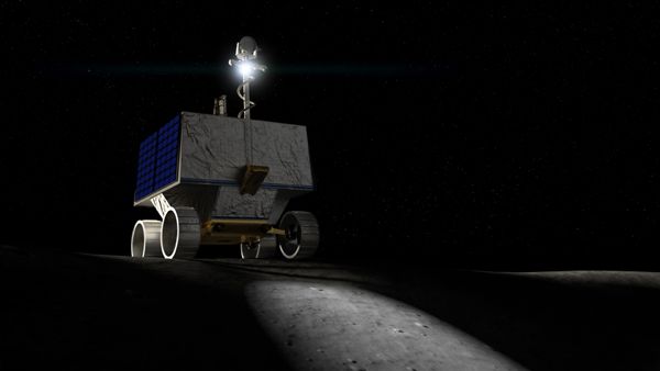
An artist's concept of NASA's VIPER rover on the surface of the Moon.
NASA Ames / Daniel Rutter

NASA’s Artemis Rover to Land Near Nobile Region of Moon’s South Pole (Press Release)

In 2023, NASA’s Volatiles Investigating Polar Exploration Rover (VIPER) will land near the western edge of the Nobile Crater at the Moon’s South Pole to map and explore the region’s surface and subsurface for water and other resources. Part of Artemis, VIPER will launch on a SpaceX Falcon Heavy rocket for delivery to the Moon by Astrobotic’s Griffin lander under NASA’s Commercial Lunar Payload Services initiative.

The Moon’s South Pole is one of the coldest areas in our solar system. No prior missions to the Moon’s surface have explored it – scientists have thus far only studied the region using remote sensing instruments, including those on NASA’s Lunar Reconnaissance Orbiter and the Lunar Crater Observation and Sensing Satellite.

Data from these and other missions helped scientists conclude that ice and other potential resources exist in permanently shadowed areas of the Moon near the poles. After an extensive landing site selection process, the mountainous area west of Nobile Crater was chosen as VIPER’s landing site due to its rover-accessible terrain and array of nearby sites of scientific interest, including permanently shadowed areas.

“Once on the lunar surface, VIPER will provide ground truth measurements for the presence of water and other resources at the Moon’s South Pole, and the areas surrounding Nobile Crater showed the most promise in this scientific pursuit,” said Thomas Zurbuchen, associate administrator for science at NASA Headquarters. “The data VIPER returns will provide lunar scientists around the world with further insight into our Moon’s cosmic origin, evolution, and history, and it will also help inform future Artemis missions to the Moon and beyond by enabling us to better understand the lunar environment in these previously unexplored areas hundreds of thousands of miles away.”

Nobile Crater is an impact crater that was formed through a collision with another smaller celestial body, and is almost permanently covered in shadows, allowing ice to exist there. Smaller, more accessible craters surrounding Nobile’s perimeter, will also provide VIPER with ideal locations to investigate in its search for ice and other resources.

“Selecting a landing site for VIPER is an exciting and important decision for all of us,” Daniel Andrews, VIPER project manager, said. “Years of study have gone into evaluating the polar region VIPER will explore. VIPER is going into uncharted territory—informed by science—to test hypotheses and reveal critical information for future human space exploration.”

Landing Site Selection

NASA’s team evaluated viable rover traverse paths, taking into account where VIPER could use its solar panels to charge and stay warm during its 100-day journey. The area near Nobile Crater provided a lot of flexibility.

VIPER’s currently planned trajectory allows the rover to visit at least six sites of scientific interest, with additional time to spare.

“Our evaluation of the landing site was driven by science priorities,” said Anthony Colaprete, VIPER lead project scientist at NASA's Ames Research Center in Silicon Valley, California. “We seek answers to some pretty complex questions and studying these resources on the Moon that have stood the test of time will help us answer them.”

The VIPER team aims to address how frozen water and other resources arrived on the Moon in the first place. They also plan to identify where they came from, how they remained preserved for billions of years, how they escape, and where they go.

VIPER’s Journey Across the Nobile Region

The area VIPER will study in the Nobile region covers an approximate surface area of 36 square miles (93 square kilometers), 10 to 15 miles (16 to 24 km) of which VIPER is expected to traverse through during the course of its mission. During this time, the rover will visit carefully chosen areas of scientific interest that will provide further insight into a wide array of different kinds of lunar environments. The VIPER team will look to characterize ice and other resources in these areas using VIPER’s sensors and drill.

As VIPER moves among each area of scientific interest, it will collect samples from at least three drill locations. Analysis of these samples from a variety of depths and temperatures will help scientists to better predict where else ice may be present on the Moon based on similar terrain, allowing NASA to produce a global resource map. This map, and the other science VIPER will produce, will allow scientists to better understand the distribution of resources on the Moon and help inform future crewed missions to establish a long-term presence on the lunar surface.

Source: NASA.Gov

****

A data visualization showing the Nobile region where NASA's VIPER rover will land at the lunar South Pole in late 2023.
NASA

Sunday, July 05, 2020

LRO Update: A New Discovery Is Made Beneath the Surface of the Moon...

An image of the Moon based on data gathered by NASA's Lunar Reconnaissance Orbiter.
NASA / GSFC / Arizona State University

Radar Points to Moon Being More Metallic Than Researchers Thought (News Release - July 1)

What started out as a hunt for ice lurking in polar lunar craters turned into an unexpected finding that could help clear some muddy history about the Moon’s formation.

Team members of the Miniature Radio Frequency (Mini-RF) instrument on NASA’s Lunar Reconnaissance Orbiter (LRO) spacecraft found new evidence that the Moon’s subsurface might be richer in metals, like iron and titanium, than researchers thought. That finding, published July 1 in Earth and Planetary Science Letters, could aid in drawing a clearer connection between Earth and the Moon.

“The LRO mission and its radar instrument continue to surprise us with new insights about the origins and complexity of our nearest neighbor,” said Wes Patterson, Mini-RF principal investigator from the Johns Hopkins Applied Physics Laboratory (APL) in Laurel, Maryland, and a study coauthor.

Substantial evidence points to the Moon as the product of a collision between a Mars-sized protoplanet and young Earth, forming from the gravitational collapse of the remaining cloud of debris. Consequently, the Moon’s bulk chemical composition closely resembles that of Earth.

Look in detail at the Moon’s chemical composition, however, and that story turns murky. For example, in the bright plains of the Moon’s surface, called the lunar highlands, rocks contain smaller amounts of metal-bearing minerals relative to Earth. That finding might be explained if Earth had fully differentiated into a core, mantle and crust before the impact, leaving the Moon largely metal-poor. But turn to the Moon’s maria — the large, darker plains — and the metal abundance becomes richer than that of many rocks on Earth.

This discrepancy has puzzled scientists, leading to numerous questions and hypotheses regarding how much the impacting protoplanet may have contributed to the differences. The Mini-RF team found a curious pattern that could lead to an answer.

Using Mini-RF, the researchers sought to measure an electrical property within lunar soil piled on crater floors in the Moon’s northern hemisphere. This electrical property is known as the dielectric constant, a number that compares the relative abilities of a material and the vacuum of space to transmit electric fields, and could help locate ice lurking in the crater shadows. The team, however, noticed this property increasing with crater size.

For craters approximately 1 to 3 miles (2 to 5 kilometers) wide, the dielectric constant of the material steadily increased as the craters grew larger, but for craters 3 to 12 miles (5 to 20 kilometers) wide, the property remained constant.

“It was a surprising relationship that we had no reason to believe would exist,” said Essam Heggy, coinvestigator of the Mini-RF experiments from the University of Southern California in Los Angeles and lead author of the published paper.

Discovery of this pattern opened a door to a new possibility. Because meteors that form larger craters also dig deeper into the Moon’s subsurface, the team reasoned that the increasing dielectric constant of the dust in larger craters could be the result of meteors excavating iron and titanium oxides that lie below the surface. Dielectric properties are directly linked to the concentration of these metal minerals.

If their hypothesis were true, it would mean only the first few hundred meters of the Moon’s surface is scant in iron and titanium oxides, but below the surface, there’s a steady increase to a rich and unexpected bonanza.

Comparing crater floor radar images from Mini-RF with metal oxide maps from the LRO Wide-Angle Camera, Japan’s Kaguya mission and NASA’s Lunar Prospector spacecraft, the team found exactly what it had suspected. The larger craters, with their increased dielectric material, were also richer in metals, suggesting that more iron and titanium oxides had been excavated from the depths of 0.3 to 1 mile (0.5 to 2 kilometers) than from the upper 0.1 to 0.3 miles (0.2 to 0.5 kilometers) of the lunar subsurface.

“This exciting result from Mini-RF shows that even after 11 years in operation at the Moon, we are still making new discoveries about the ancient history of our nearest neighbor,” said Noah Petro, the LRO project scientist at NASA’s Goddard Space Flight Center in Greenbelt, Maryland. “The MINI-RF data is incredibly valuable for telling us about the properties of the lunar surface, but we use that data to infer what was happening over 4.5 billion years ago!”

These results follow recent evidence from NASA’s Gravity Recovery and Interior Laboratory (GRAIL) mission that suggests a significant mass of dense material exists just a few tens to hundreds of kilometers beneath the Moon’s enormous South Pole-Aitken basin, indicating that dense materials aren’t uniformly distributed in the Moon’s subsurface.

The team emphasizes that the new study can’t directly answer the outstanding questions about the Moon’s formation, but it does reduce the uncertainty in the distribution of iron and titanium oxides in the lunar subsurface and provide critical evidence needed to better understand the Moon’s formation and its connection to Earth.

“It really raises the question of what this means for our previous formation hypotheses,” Heggy said.

Anxious to uncover more, the researchers have already started examining crater floors in the Moon’s southern hemisphere to see if the same trends exist there.

LRO is managed by NASA’s Goddard Space Flight Center in Greenbelt, Maryland for the Science Mission Directorate at NASA Headquarters in Washington. Mini-RF was designed, built and tested by a team led by APL, Naval Air Warfare Center, Sandia National Laboratories, Raytheon and Northrop Grumman.

Source: NASA.Gov

Friday, October 25, 2019

NASA to Launch a Rover That Will Explore the South Pole of the Moon in 2022...

An artist's concept of NASA's VIPER rover on the surface of the Moon.
NASA Ames / Daniel Rutter

New VIPER Lunar Rover to Map Water Ice on the Moon (News Release)

NASA is sending a mobile robot to the South Pole of the Moon to get a close-up view of the location and concentration of water ice in the region and for the first time ever, actually sample the water ice at the same pole where the first woman and next man will land in 2024 under the Artemis program.

About the size of a golf cart, the Volatiles Investigating Polar Exploration Rover, or VIPER, will roam several miles, using its four science instruments — including a 1-meter drill — to sample various soil environments. Planned for delivery to the lunar surface in December 2022, VIPER will collect about 100 days of data that will be used to inform the first global water resource maps of the Moon.

“The key to living on the Moon is water – the same as here on Earth,” said Daniel Andrews, the project manager of the VIPER mission and director of engineering at NASA’s Ames Research Center in Silicon Valley. “Since the confirmation of lunar water-ice ten years ago, the question now is if the Moon could really contain the amount of resources we need to live off-world. This rover will help us answer the many questions we have about where the water is, and how much there is for us to use.”

NASA's Artemis program begins a new era where robots and humans working together will push the boundaries of what’s possible in space exploration. In collaboration with commercial and international partners, NASA’s ambition is to achieve a long-term sustainable presence on the Moon – enabling humans to go on to Mars and beyond.

Scientists had long considered the lunar poles as promising spots to find water ice – a resource of direct value for humans that could provide oxygen to breathe and hydrogen and oxygen to fuel future landers and rockets. The Moon’s tilt creates permanently shadowed regions where water ice from comet and meteor impacts, as well as the Sun’s interaction with the lunar soil, can collect without being melted by sunlight. In 2009, NASA crashed a rocket (as part of the ongoing Lunar Reconnaissance Orbiter mission) into a large crater near the South Pole and directly detected the presence of water ice. Data from this mission and other orbiters have confirmed that the Moon has reservoirs of water ice, potentially amounting to millions of tons. Now, we need to understand the location and nature of the water and other potentially accessible resources to aid in planning how to extract and collect it.

“It’s incredibly exciting to have a rover going to the new and unique environment of the South Pole to discover where exactly we can harvest that water,” said Anthony Colaprete, VIPER’s project scientist. “VIPER will tell us which locations have the highest concentrations and how deep below the surface to go to get access to water.”

To unravel the mysteries of the Moon’s South Pole, the rover will collect data on different kinds of soil environments affected by light and temperature – those in complete darkness, occasional light and in direct sunlight. By collecting data on the amount of water and other materials in each, NASA can map out where else water likely lies across the Moon.

As the rover drives across the surface, it will use the Neutron Spectrometer System, known as NSS, to detect “wet” areas below the surface for further investigation. VIPER will then stop and deploy a drill, The Regolith and Ice Drill for Exploring New Terrain, or TRIDENT, developed with Honeybee Robotics, to dig up soil cuttings from up to a meter beneath the surface. These drill samples will then be analyzed by two instruments: the Mass Spectrometer Observing Lunar Operations, or MSolo, developed out of NASA’s Kennedy Space Center; and the Near InfraRed Volatiles Spectrometer System, known as NIRVSS, developed by Ames. MSolo and NIRVSS will determine the composition and concentration of potentially accessible resources, including water, that were brought up by TRIDENT.

VIPER is a collaboration within and beyond the agency. VIPER is part of the Lunar Discovery and Exploration Program managed by the Science Mission Directorate at NASA Headquarters. Ames is managing the rover project, leading the mission’s science, systems engineering, real-time rover surface operations and software development. The hardware for the rover is being designed by the Johnson Space Center, while the instruments are provided by Ames, Kennedy, and commercial partner, Honeybee Robotics. The spacecraft lander and launch vehicle that will deliver VIPER to the surface of the Moon, will be provided through NASA’s Commercial Lunar Payload Services (CLPS) contract, delivering science and technology payloads to and near the Moon.

Source: NASA.Gov

****

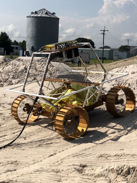
An engineering model of the VIPER lunar rover rolls along a testbed at NASA's Johnson Space Center in Houston, Texas.
NASA / Johnson Space Center

Wednesday, May 15, 2019

The Final Resting Place for Israel's First Moon Lander Is Spotted from Lunar Orbit...

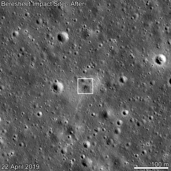
An image of the crash site of Israel's Beresheet lunar lander...taken on April 22, 2019.
NASA / GSFC / Arizona State University

Beresheet Impact Site Spotted (News Release)

The photo above shows the landing site of the Israeli Beresheet spacecraft on a region of the Moon called Sea of Serenity, or Mare Serenitatis in Latin. On April 11, 2019, SpaceIL, a non-profit organization, attempted to land its spacecraft in this ancient volcanic field on the nearside of the Moon. After a smooth initial descent, Beresheet made a hard landing on the surface.

As soon as its orbit placed NASA’s Lunar Reconnaissance Orbiter (LRO) over the landing site on April 22, 2019, LRO imaged Beresheet’s impact site. The LRO Camera (LROC) consists of three imagers: a seven-color Wide Angle Camera (WAC) and two black-and-white Narrow Angle Cameras (NAC) mounted on the LRO, which has been studying the Moon from orbit for a decade. NAC captured the Beresheet impact photo.

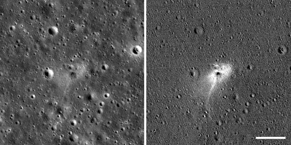
Unprocessed and processed versions of the image showing the crash site of Israel's Beresheet lunar lander...taken on April 22, 2019.
NASA / GSFC / Arizona State University

LROC took this image from 56 miles (90 kilometers) above the surface. The cameras captured a dark smudge, about 10 meters wide, that indicates the point of impact. The dark tone suggests a surface roughened by the hard landing, which is less reflective than a clean, smooth surface.

From so far away, LROC could not detect whether Beresheet formed a surface crater upon impact. It’s possible the crater is just too small to show up in photos. Another possibility is that Beresheet formed a small indent instead of a crater, given its low angle of approach (around 8.4 degrees relative to the surface), light mass (compared to a dense meteoroid of the same size), and low velocity (again, relative to a meteoroid of the same size; Beresheet’s speed was still faster than most speeding bullets).

The light halo around the smudge could have formed from gas associated with the impact or from fine soil particles blown outward during Beresheet’s descent, which smoothed out the soil around the landing site, making it highly reflective.

There are many clues that we’re actually looking at a man-made crater instead of a meteoroid-caused one. This is an important consideration, since the Moon, having no atmosphere, is constantly bombarded by space rocks that leave craters.

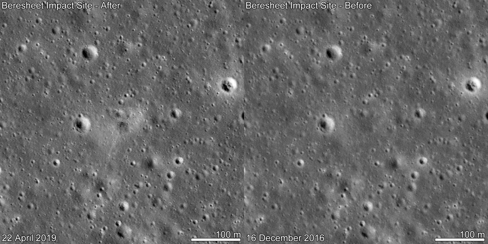
Most importantly, we knew the coordinates of the landing site within a few miles thanks to radio tracking of Beresheet, and we have 11 “before” images of the area, spanning a decade, and three “after” images. In all of these images, including one taken 16 days before the landing, we saw only one new feature of the size Beresheet would have created.

Existing mathematical models helped us estimate the size and shape of the crater that would have formed if an object of Beresheet’s mass and velocity struck the surface. We also referenced craters created by similar-size spacecraft (GRAIL, LADEE, Ranger) that have struck the Moon at about the same speed, and we saw that the white tail stretching from the landing halo towards the south is a shape that’s consistent with Beresheet’s southward descent trajectory and angle of approach.

For the before image below, we used a photo from December 16, 2016. This is because the lighting conditions that day, based on the angle at which the Sun would have illuminated the Moon at that particular time in its orbit, were the most similar to the April 22 image. Because LRO was beyond the horizon during Beresheet’s descent and landing, it couldn’t capture a photo until its orbit brought it nearby 11 days later. LRO passes over the lunar poles with each revolution. Meanwhile, the Moon rotates on its axis below the spacecraft, allowing LRO to pass over every part of the Moon twice a month (once during lunar night and once during lunar day). LROC may take more images of the landing site when it passes the same area again on May 19.

Efforts are ongoing to bounce laser pulses from the Lunar Orbiter Laser Altimeter, also on board LRO, to measure the return from the Laser Retroreflector Array of small corner cube mirrors. This instrument was provided by NASA’s Goddard Space Flight Center and was installed on the top deck of the Beresheet spacecraft. Attempts are ongoing to examine if the retroreflector may have survived the impact.

Source: NASA.Gov

****

An animated GIF showing before and after images (taken on December 16, 2016 and April 22, 2019, respectively) of the crash site of Israel's Beresheet lunar lander.
NASA / GSFC / Arizona State University

Saturday, April 06, 2019

Photos of the Day: Beresheet's First Close-up Images of the Moon!

An image of the far side of the Moon that was taken by Israel's Beresheet lunar lander from an altitude of 470 kilometers (292 miles)...on April 4, 2019.
SpaceIL

Last Thursday, Israel's Beresheet lander took these photos of the Moon's surface just as the four-legged spacecraft fired its main engine to insert itself into lunar orbit. The far side of the Moon, shown above, was taken by Beresheet from an altitude of 470 kilometers (292 miles) above the ancient craters. In the pic below, Earth is visible about 386,160 kilometers (240,000 miles) away as the lunar lander ventured near the sunlit side of the Moon during the orbit-insertion maneuver.

Over the next four days, the flight team at SpaceIL in Israel will conduct final checks and make sure that all calculations are correct and complete as Beresheet hopefully makes its historic landing at Mare Serenitatis ("Sea of Serenity") this Thursday, April 11. Beresheet will then go from giving Israel the honor of being the seventh nation to orbit the Moon [behind the United States (whose Lunar Reconnaissance Orbiter is still operational at Earth's closest celestial neighbor), the former Soviet Union, India, China, the European Space Agency and Japan (which sent its Kaguya orbiter to the Moon in 2007)] to attaining the prestigious title of becoming the first country to soft-land a privately-funded spacecraft on the lunar surface. Of course, this would complement Israel's position of being the fourth nation (behind the United States, the former Soviet Union and China) to land a robotic probe on the Moon, overall. Very exciting!

Earth is visible about 386,160 kilometers (240,000 miles) away as Israel's Beresheet lunar lander took this image near the sunlit side of the Moon...on April 4, 2019.
SpaceIL

Friday, January 11, 2019

About China Landing a Spacecraft on the Far Side of the Moon...

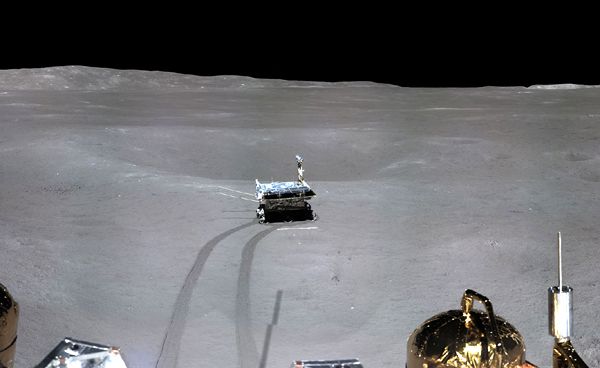
A snapshot of the Yutu-2 rover that was taken by the Chang'e 4 lander on the far side of the Moon.
CNSA

HEY CHINA, I would like to say thanks for allowing the general public to submit their names online so that they could join the Chang'e 4 lander and Yutu-2 rover on the far side of the Moon...just like how Japan's space agency and NASA allowed people to fly their names on the Kaguya spacecraft and Lunar Reconnaissance Orbiter about a decade ago, respectively. Oh wait— You didn't invite the public to fly their names on the Chang'e 4 mission to the Moon...

THANKS FOR NOTHING, JERKS.

Wednesday, October 10, 2018

A New Development for SpaceIL as Israel's First Moon Mission Marches on Towards Launch...

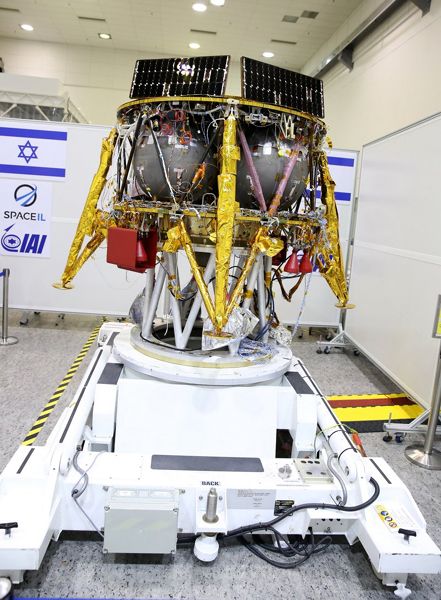
An image of SpaceIL's lunar lander at its assembly facility in Israel.
SpaceIL

NASA, Israel Space Agency Sign Agreement for Commercial Lunar Cooperation (Press Release - October 3)

NASA has signed an agreement with the Israel Space Agency (ISA) to cooperatively utilize the Israeli nonprofit SpaceIL’s commercial lunar mission, expected to land on the Moon in 2019.

NASA will contribute a laser retroreflector array to aid with ground tracking and Deep Space Network support to aid in mission communication. ISA and SpaceIL will share data with NASA from the SpaceIL lunar magnetometer installed aboard the spacecraft. The instrument, which was developed in collaboration with the Weizmann Institute of Science, will measure the magnetic field on and above the landing site. The data will be made publicly available through NASA’s Planetary Data System. In addition, NASA’s Lunar Reconnaissance Orbiter will attempt to take scientific measurements of the SpaceIL lander as it lands on the Moon.

The agreement was signed by NASA Administrator Jim Bridenstine and Avi Blasberger, Director of the Israel Space Agency. Dr. Ido Anteby, CEO of SpaceIL, was also present.

“I’m thrilled to extend progress in commercial cooperation we’ve made in low-Earth orbit to the lunar environment with this new agreement with the Israel Space Agency and SpaceIL,” said NASA Administrator Jim Bridenstine. “Innovative partnerships like this are going to be essential as we go forward to the Moon and create new opportunities there.”

SpaceIL competed in the Google Lunar X Prize, and continues to work toward landing the first Israeli spacecraft on the Moon. Together, NASA and SpaceIL will collaborate on analyzing the scientific data returned from the mission.

The agreement exemplifies the innovative approach that NASA and its international partners are taking to team up with commercial partners to advance important science and exploration objectives on and around the Moon.

****

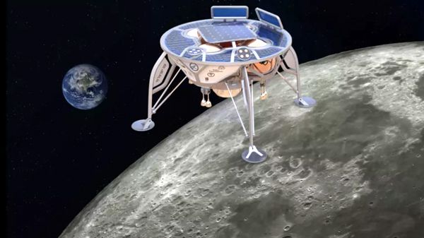
An artist's concept of SpaceIL's lunar lander approaching the surface of the Moon.An artist's concept of SpaceIL's lunar lander approaching the surface of the Moon.
SpaceIL

Friday, September 14, 2018

Photos of the Day: Commemorating the Final Launch of the Delta II Rocket...

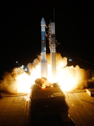
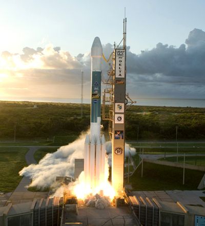
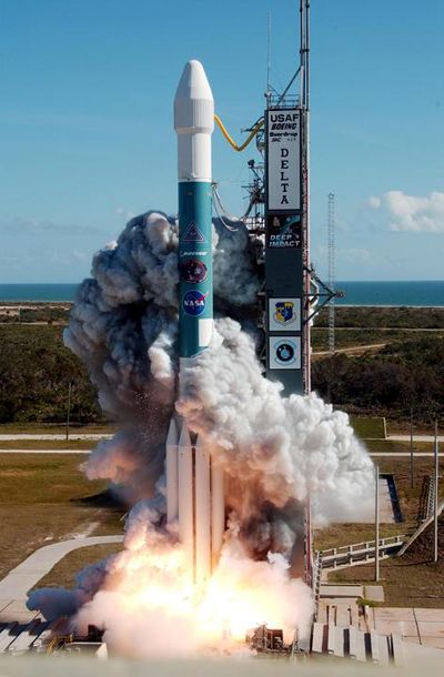
A Delta II rocket carrying NASA's comet-bound Deep Impact spacecraft launches from Cape Canaveral Air Force Station (CCAFS) in Florida...on January 12, 2005.
NASA

At 5:46 AM, Pacific Daylight Time tomorrow, a Delta II rocket is set to launch from Vandenberg Air Force Base in California...carrying NASA's ICESat-2 spacecraft to a polar orbit around the Earth. What makes this flight special, and sad, is that this is the final flight of the Delta II vehicle before it is retired for good. I was pondering for the last two months about whether or not I should make the drive to Ventura County (where Vandenberg is located) to watch the Delta II soar into the sky one last time. Ultimately, and unfortunately, I decided not to go since I've been strapped financially for much of 2018 and can't afford to spend cash on gas, hotel room and other expenses if I made the trip to Central California. Considering the fact that the weather is currently 100% 'GO' for liftoff on Saturday morning, it seems like the rocket gods are trying to make me regret my decision. Here's hoping that some type of minor mechanical issue will crop up that'll delay the Delta II's launch a few days—just to ease my guilt of not going!

To honor the venerable Delta II, here are photos of the four vehicles that launched NASA spacecraft which had my name as well as those of thousands of others on them:

- TOP PHOTO: A Delta II rocket carrying the comet-bound Deep Impact spacecraft (whose now-obliterated impactor held a CD containing the names of 625,000 people, including mine) launched from Cape Canaveral Air Force Station (CCAFS) in Florida on January 12, 2005.

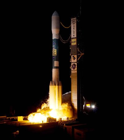
- PHOTO DIRECTLY BELOW: A Delta II rocket carrying the Mars-bound Phoenix lander (whose DVD holds the names of 250,000 people, including mine) launched from CCAFS on August 4, 2007.

- SECOND PHOTO FROM THE BOTTOM: A Delta II rocket carrying the asteroid and dwarf planet-bound Dawn space probe (whose microchip is imprinted with the names of 365,000 people, including mine) lifted off from CCAFS on September 27, 2007.

And last, but definitely not least...

- THE PHOTO AT THE VERY BOTTOM OF THIS ENTRY: A Delta II vehicle carrying the exoplanet-hunting Kepler space telescope (whose DVD is encoded with the names and messages of 60,000 people, including mine) departed from CCAFS on March 6, 2009.

All I can say is, when the day comes that the Atlas V rocket (which sent the Curiosity Mars rover, the Lunar Reconnaissance Orbiter, the MAVEN spacecraft and InSight Mars lander—which all have my name on them as well—to their deep-space destinations over the past decade) is about to be retired, I'll definitely make the effort to see its final launch in person. Assuming, of course, that its last flight also takes place from Ventura County. Whether or not its final payload is an interplanetary NASA spacecraft or a classified military satellite won't matter. I just want to see one of these marvels of human engineering leave Earth's atmosphere in person before it's grounded permanently. Have a great weekend!

A Delta II rocket carrying NASA's Phoenix Mars lander launches from CCAFS in Florida...on August 4, 2007.
NASA

A Delta II rocket carrying NASA's asteroid and dwarf planet-bound Dawn spacecraft launches from CCAFS in Florida...on September 27, 2007.
NASA

A Delta II rocket carrying NASA's exoplanet-hunting Kepler space telescope launches from CCAFS in Florida...on March 6, 2009.
NASA

Friday, July 01, 2016

Onward to MU69: NASA Approves New Horizons' Extended Mission to KBO Target!

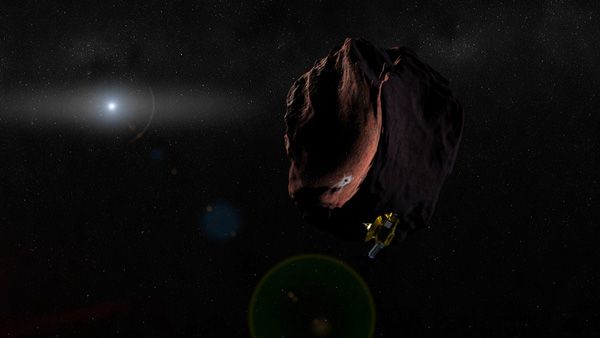
An artist's concept of NASA's New Horizons spacecraft flying past a Kuiper Belt Object.
NASA / Johns Hopkins University Applied Physics Laboratory / Southwest Research Institute

New Horizons Receives Mission Extension to Kuiper Belt, Dawn to Remain at Ceres (Press Release)

Following its historic first-ever flyby of Pluto, NASA’s New Horizons mission has received the green light to fly onward to an object deeper in the Kuiper Belt, known as 2014 MU69. The spacecraft’s planned rendezvous with the ancient object – considered one of the early building blocks of the solar system -- is Jan. 1, 2019.

“The New Horizons mission to Pluto exceeded our expectations and even today the data from the spacecraft continue to surprise,” said NASA’s Director of Planetary Science Jim Green. “We’re excited to continue onward into the dark depths of the outer solar system to a science target that wasn’t even discovered when the spacecraft launched.”

Based upon the 2016 Planetary Mission Senior Review Panel report, NASA this week directed nine extended missions to plan for continued operations through fiscal years 2017 and 2018. Final decisions on mission extensions are contingent on the outcome of the annual budget process.

In addition to the extension of the New Horizons mission, NASA determined that the Dawn spacecraft should remain at the dwarf planet Ceres, rather than changing course to the main belt asteroid Adeona.

Green noted that NASA relies on the scientific assessment by the Senior Review Panel in making its decision on which extended mission option to approve. “The long-term monitoring of Ceres, particularly as it gets closer to perihelion – the part of its orbit with the shortest distance to the sun -- has the potential to provide more significant science discoveries than a flyby of Adeona,” he said.

Also receiving NASA approval for mission extensions, contingent on available resources, are: the Mars Reconnaissance Orbiter (MRO), Mars Atmosphere and Volatile EvolutioN (MAVEN), the Opportunity and Curiosity Mars rovers, the Mars Odyssey orbiter, the Lunar Reconnaissance Orbiter (LRO), and NASA’s support for the European Space Agency’s Mars Express mission.

Source: NASA.Gov

****

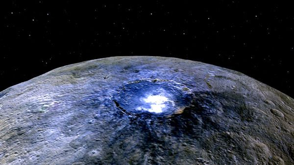
A false-color image taken by NASA's Dawn spacecraft of the Occator crater on dwarf planet Ceres.
NASA / JPL - Caltech / UCLA / MPS / DLR / IDA

Thursday, December 31, 2015

Final Post of 2015: An Amazing Photo Taken by LRO...

An image of Earth and the Moon taken by NASA's Lunar Reconnaissance Orbiter spacecraft...on October 12, 2015.
NASA / Goddard / Arizona State University

NASA Releases New High-Resolution Earthrise Image (Press Release - December 18)

NASA's Lunar Reconnaissance Orbiter (LRO) recently captured a unique view of Earth from the spacecraft's vantage point in orbit around the moon.

"The image is simply stunning," said Noah Petro, Deputy Project Scientist for LRO at NASA's Goddard Space Flight Center in Greenbelt, Maryland. "The image of the Earth evokes the famous 'Blue Marble' image taken by Astronaut Harrison Schmitt during Apollo 17, 43 years ago, which also showed Africa prominently in the picture."

In this composite image we see Earth appear to rise over the lunar horizon from the viewpoint of the spacecraft, with the center of the Earth just off the coast of Liberia (at 4.04 degrees North, 12.44 degrees West). The large tan area in the upper right is the Sahara Desert, and just beyond is Saudi Arabia. The Atlantic and Pacific coasts of South America are visible to the left. On the moon, we get a glimpse of the crater Compton, which is located just beyond the eastern limb of the moon, on the lunar farside.

LRO was launched on June 18, 2009, and has collected a treasure trove of data with its seven powerful instruments, making an invaluable contribution to our knowledge about the moon. LRO experiences 12 earthrises every day; however the spacecraft is almost always busy imaging the lunar surface so only rarely does an opportunity arise such that its camera instrument can capture a view of Earth. Occasionally LRO points off into space to acquire observations of the extremely thin lunar atmosphere and perform instrument calibration measurements. During these movements sometimes Earth (and other planets) pass through the camera's field of view and dramatic images such as the one shown here are acquired.

This image was composed from a series of images taken Oct. 12, when LRO was about 83 miles (134 kilometers) above the moon's farside crater Compton. Capturing an image of the Earth and moon with LRO's Lunar Reconnaissance Orbiter Camera (LROC) instrument is a complicated task. First the spacecraft must be rolled to the side (in this case 67 degrees), then the spacecraft slews with the direction of travel to maximize the width of the lunar horizon in LROC's Narrow Angle Camera image. All this takes place while LRO is traveling faster than 3,580 miles per hour (over 1,600 meters per second) relative to the lunar surface below the spacecraft!

The high-resolution Narrow Angle Camera (NAC) on LRO takes black-and-white images, while the lower resolution Wide Angle Camera (WAC) takes color images, so you might wonder how we got a high-resolution picture of the Earth in color. Since the spacecraft, Earth, and moon are all in motion, we had to do some special processing to create an image that represents the view of the Earth and moon at one particular time. The final Earth image contains both WAC and NAC information. WAC provides the color, and the NAC provides high-resolution detail.

"From the Earth, the daily moonrise and moonset are always inspiring moments," said Mark Robinson of Arizona State University in Tempe, principal investigator for LROC. "However, lunar astronauts will see something very different: viewed from the lunar surface, the Earth never rises or sets. Since the moon is tidally locked, Earth is always in the same spot above the horizon, varying only a small amount with the slight wobble of the moon. The Earth may not move across the 'sky', but the view is not static. Future astronauts will see the continents rotate in and out of view and the ever-changing pattern of clouds will always catch one's eye, at least on the nearside. The Earth is never visible from the farside; imagine a sky with no Earth or moon - what will farside explorers think with no Earth overhead?"
NASA's first Earthrise image was taken with the Lunar Orbiter 1 spacecraft in 1966. Perhaps NASA's most iconic Earthrise photo was taken by the crew of the Apollo 8 mission as the spacecraft entered lunar orbit on Christmas Eve Dec. 24, 1968. That evening, the astronauts -- Commander Frank Borman, Command Module Pilot Jim Lovell, and Lunar Module Pilot William Anders -- held a live broadcast from lunar orbit, in which they showed pictures of the Earth and moon as seen from their spacecraft. Said Lovell, "The vast loneliness is awe-inspiring and it makes you realize just what you have back there on Earth."

Source: NASA.Gov